![]()
|
|
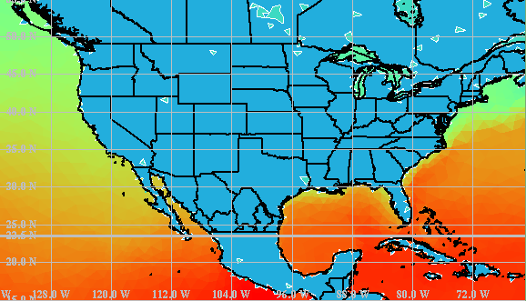
Introduction and OverviewSAIC's Center for Atmospheric Physics (CAP) has developed a novel multiscale atmospheric simulation system for advanced, high-resolution weather forecasting and forecasting dosage and hazard levels due to the atmospheric release of aerosols and gases. The Operational Multiscale Environment model with Grid Adaptivity (OMEGA), has a horizontal grid resolution that ranges from 100 km to 1 km and a vertical resolution that ranges from a few meters to 1 km. OMEGA represents a significant advance in the field of weather prediction. Operational forecast models in current use are scale-specific. Their fixed rectangular grid structure limits the resolution of both the input boundary conditions and the resulting atmospheric simulation. The OMEGA model grid, which is unstructured in the horizontal, adapts to the underlying surface features and can dynamically adapt to atmospheric phenomena as they evolve. The major advantages of OMEGA over the current state-of-the-art include the ability to resolve the surface terrain down to scales of 1 km and along with that the local perturbations on the larger scale wind field. This local wind field perturbation is of extreme importance in determining the trajectory of an aerosol or gas release or plume. However, in order to calculate this local perturbation, it is important to include all of the physical parameters and processes which affect the local flow. These include not only the topography, but the land use, the land/water composition, the vegetation, the soil moisture, the snow cover (if appropriate), and the surface moisture and energy budgets. The inclusion of this additional physics, some of which is only appropriate because of the increased spatial resolution, represents an additional advance in the state-of-the-art. OMEGA uses a non-hydrostatic equation set to describe the dynamics. Cloud formation growth and precipitation processes are simulated by bulk-water parameterization schemes. A convective parameterization scheme is used in regions of coarse resolution where the potential exists for convection to occur. The model includes a radiation package which approximates the effects of the atmosphere and clouds on the radiation budget. OMEGA has an embedded Atmospheric Dispersion Model (ADM) that permits the simulation of aerosol or gas dispersion in the atmosphere using either an Eulerian (grid based) or a Lagrangian (particle or puff) scheme. ADM can provide accurate Lagrangian tracer capability specifically adapted to the atmospheric transport of hazardous aerosols and gases. ADM also permits the generation of thousands of pseudo-releases that can be post-processed to provide either "what-if" analyses or to provide information on the origin of a observed airborne hazard. OMEGA is more than an atmospheric forecasting and dispersion model; it is a complete forecasting and dispersion system. The OMEGA system consists of:
The resulting modeling system is capable of rapid-reconfiguration for operation anywhere in the world, with automatic linkage to baseline datasets and real-time meteorological data feeds. In the remaining pages, we will briefly discuss some of the features of OMEGA. |
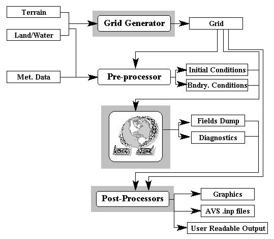 Figure 1. The OMEGA Modeling System. |
| A key advantage of OMEGA is its integrated GUI (Figure 2). XOMEGA provides a
user-friendly method for the rapid re-configuration of the model. Starting from a browse
map of the world, an operator can use XOMEGA to set-up and start a simulation anywhere
in the world in a matter of minutes. This compares with reconfiguration times of hours
to days for most operational weather forecast modeling systems. |
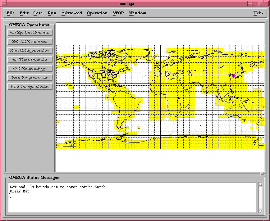 Figure 2. XOMEGA, the OMEGA GUI |
| One factor in the reconfiguration is the world-wide elevation and land/water boundary
datasets. The OMEGA system includes moderate resolution (5 arc-minute) and high resolution
(30 arc-second) elevation and land/water datasets. In addition, a single tile of 3
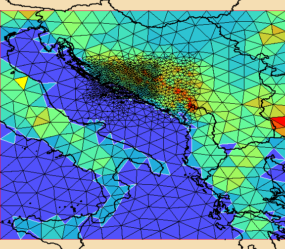
arc-second data can be automatically ingested. Figure 3 shows the OMEGA terrain data for
Bosnia-Herzegovina; Figure 4 shows an OMEGA grid for the region. Figure 5 shows some of
the static and climatological datasets that the OMEGA grid generator accesses to provide
surface information to the OMEGA model. |
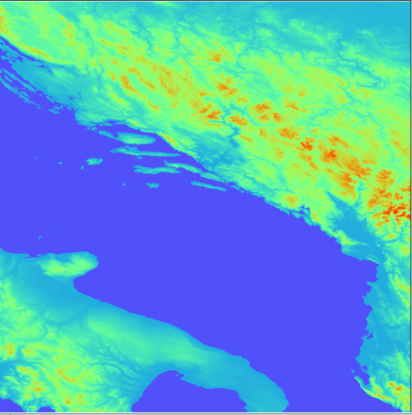 Figure 3. OMEGA 30 arc-second data for Bosnia-Herzegovina. This data was used to create the OMEGA grid seen in Figure 4.
Figure 4. OMEGA Grid for Bosnia-Herzegovina.
(a)
(b)
(c)
(d)
(e)
(f)
(g)
(h) |
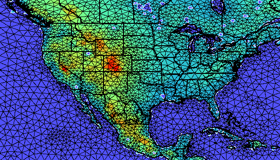
| Figure 5. The OMEGA grid generator automatically accesses both static and
climatological surface datasets. The OMEGA grid (a) has been used to access static
elevation (b), land use (c), and soil type (d) data, as well as climatological vegetation
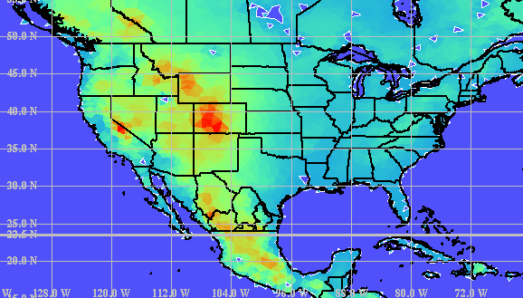
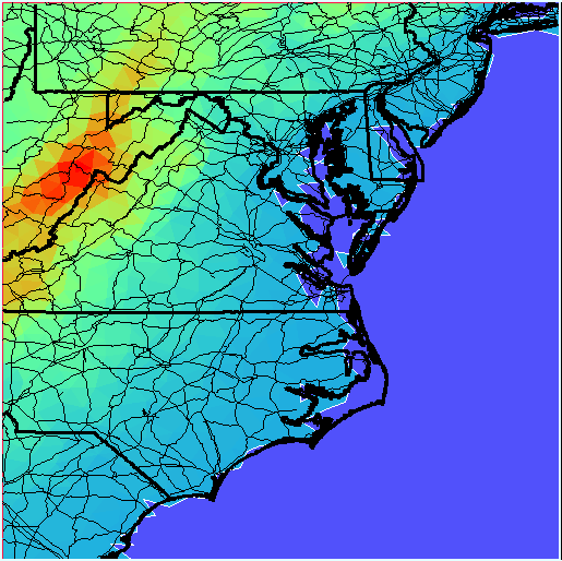
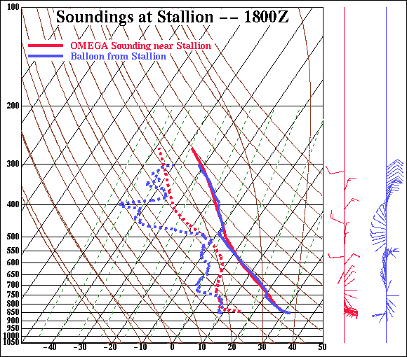
(e), soil temperature (f), soil moisture (g), and sea surface temperature (h) data. XGRID, the X-windows graphics post-processing and analysis tool developed for OMEGA, brings a wealth of functionality to the OMEGA modeling system. XGRID includes the ability to overlay OMEGA output on mapping data from the Digital Chart of the World. XGRID also permits the examination of vertical cross-sections of the OMEGA output, and the creation of standard skewT-logP diagrams. Using XGRID, the operator can examine both meteorological and ADM results. A scripting capability makes it easy to create routine products automatically, creating either Postscript™ or GIF files that can be spooled into a printer or incorporated into other products, or MPEG animations. Figure 6 provides examples of each of these XGRID capabilities.
(a)
(b)
(c)
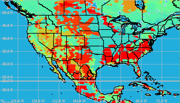
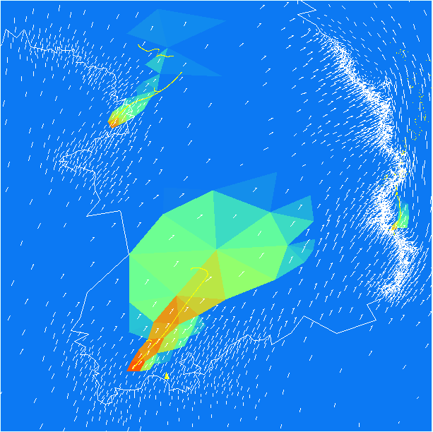
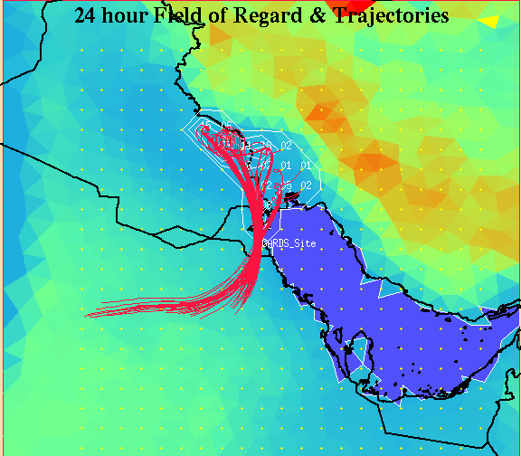
(d) Figure 6. Examples of XGRID, the X-windows graphics post-processor for OMEGA. XGRID permits the display of: (a) OMEGA products overlaid on Digital Chart of the World mapping information; (b) vertical slices through the OMEGA output; (c) standard skewT-logP sounding diagrams; and (d) the Eulerian (grid based) and Lagrangian (particle or puff) dispersion results. A recent addition to OMEGA is a back-trajectory analysis system. Using the pseudo-release capability of OMEGA, and post-processing tools, OMEGA is capable of providing information on the likely point of origin of a pollutant. Figure 7 shows a demonstration of this capability in which pseudo-release trajectories were post-processed to display only those that passed through an observation point during a given 24 hour measurement period. The points of origin of those trajectories form a field-of-regard for the station and the number of trajectories from a each release point that pass through the observation point can be used to determine the probability of release contours shown in white.
Figure 7. OMEGA back-trajectory analysis. Here the trajectories of all of the pseudo-releases passing through a Global Atmospheric Radionuclide Detection System (GARDS) station for 24 hours are shown as well as the percentage of trajectories originating at each location. OMEGA was designed for existing CRAY class super-computers with a goal of being operational on a Teraflop (sustained) class machine by 1997. This class of machine will enable OMEGA to operate with hemispheric resolution that is better than today's global models, and with a highest resolution of 1 km. OMEGA is dynamically memory managed, however, and thus is capable of operating on workstations, albeit not operationally with 1 km resolution over a large area. OMEGA is currently operational on IBM RS/6000, SGI Onyx, and DEC Alpha workstations. OMEGA has valuable applications in numerous weather prediction and aerosol transport problems. The model can play a major role in short and medium range weather forecasting, especially of systems that are influenced by topography and other surface features. It will also be able to address environmental problems ranging from urban air quality and compliance with U.S. Environmental Protection Agency regulations to emergency response to toxic releases. Further information on OMEGA can be obtained from Dr. David Bacon, Director, Center for Atmospheric Physics, Science Applications International Corporation, 1710 Goodridge Dr., McLean, VA 22102. Dr. Bacon may also be contacted by phone at (703)821-4594, by FAX at (703)821-1134, or by e-mail at bacon@apo.saic.com. |
| (C) 1997 SAIC. Revised 1997-07-01 |
ATG Home | Advanced Sciences | Advanced Systems |